Flash flood in Northern Italy

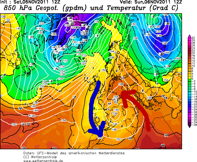
Foehn winds in the Alpine area are definitely not a unconvenient situation during autumn. But the current synoptic setup results has some extreme effects. On the southern part of the Alpine arc the accumulated rain exceeded several 100mm while in Germany temperatures up to 24 °C were observed.

Let’s have a look at the current synoptic setup:
(more…)

IPCC AR4 – Summary

In this post I’m going to sum up the most important statements of the IPCC AR4 report. The reason for doing this is to have a easy to scan source for myself and everyone interested in this topic. I think it’s one of the great advantages of a blog system to easily share material you otherwise would only produce for yourself. And so other persons may benefit from it, too. I’d appreciate any of your comments :)

The full report from which the following summary is created can be found at: http://www.ipcc.ch/pdf/assessment-report/ar4/syr/ar4_syr.pdf

(more…)

Fog in satellite images

Winter last year i stumbled over a satellite image product at wetteronline.de. I don’t know how the cloud mask on this site is created but it seemed to have a problem with fog. Looking at this image only one gets the impression that there are absolutely no clouds over Germany. Looking into the sky proves that it is foggy. So this cloud mask could be a little bit misleading when used for example for estimating temperatures.

But how can this difference of observation and product be explained?

(more…)